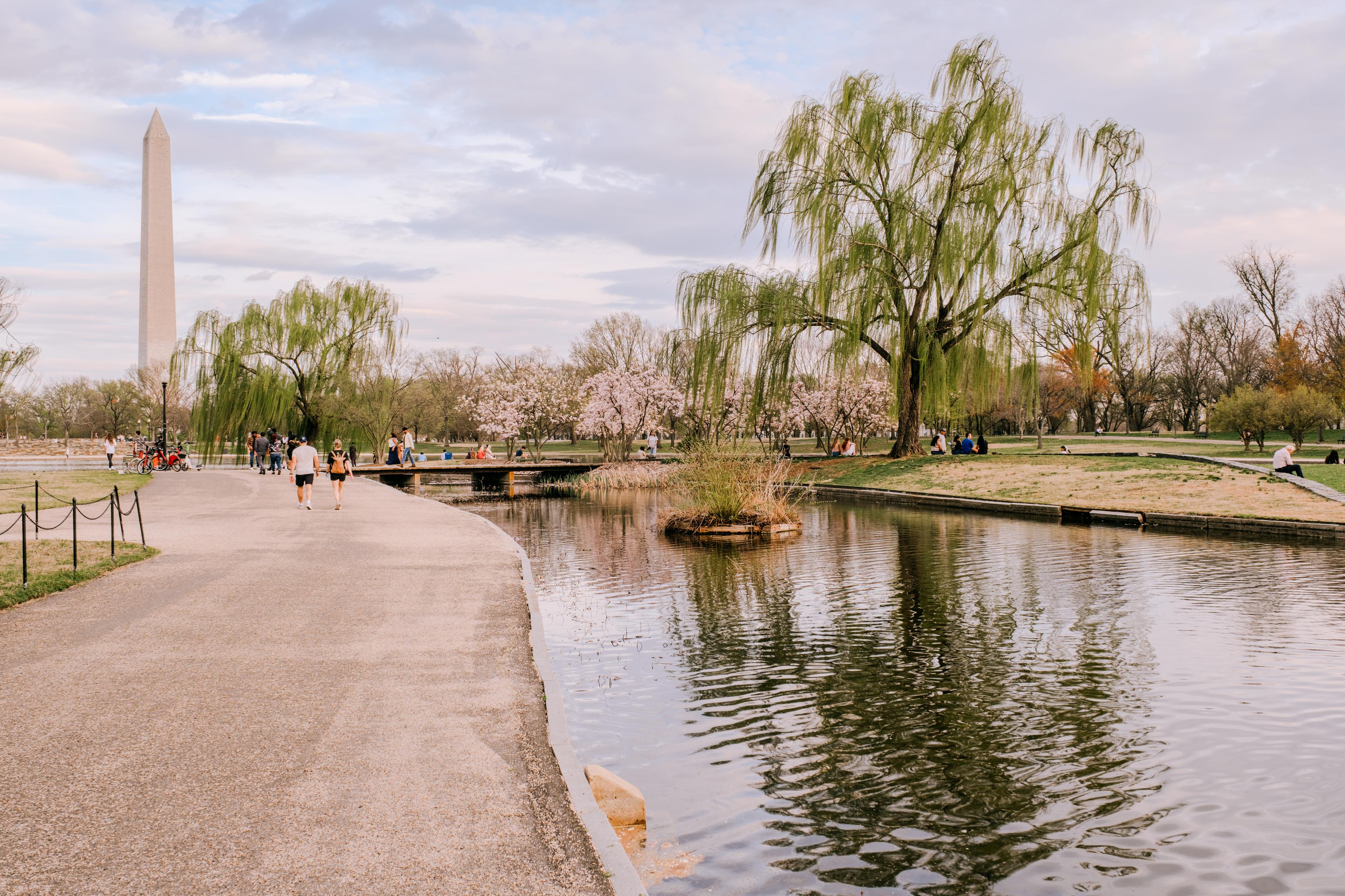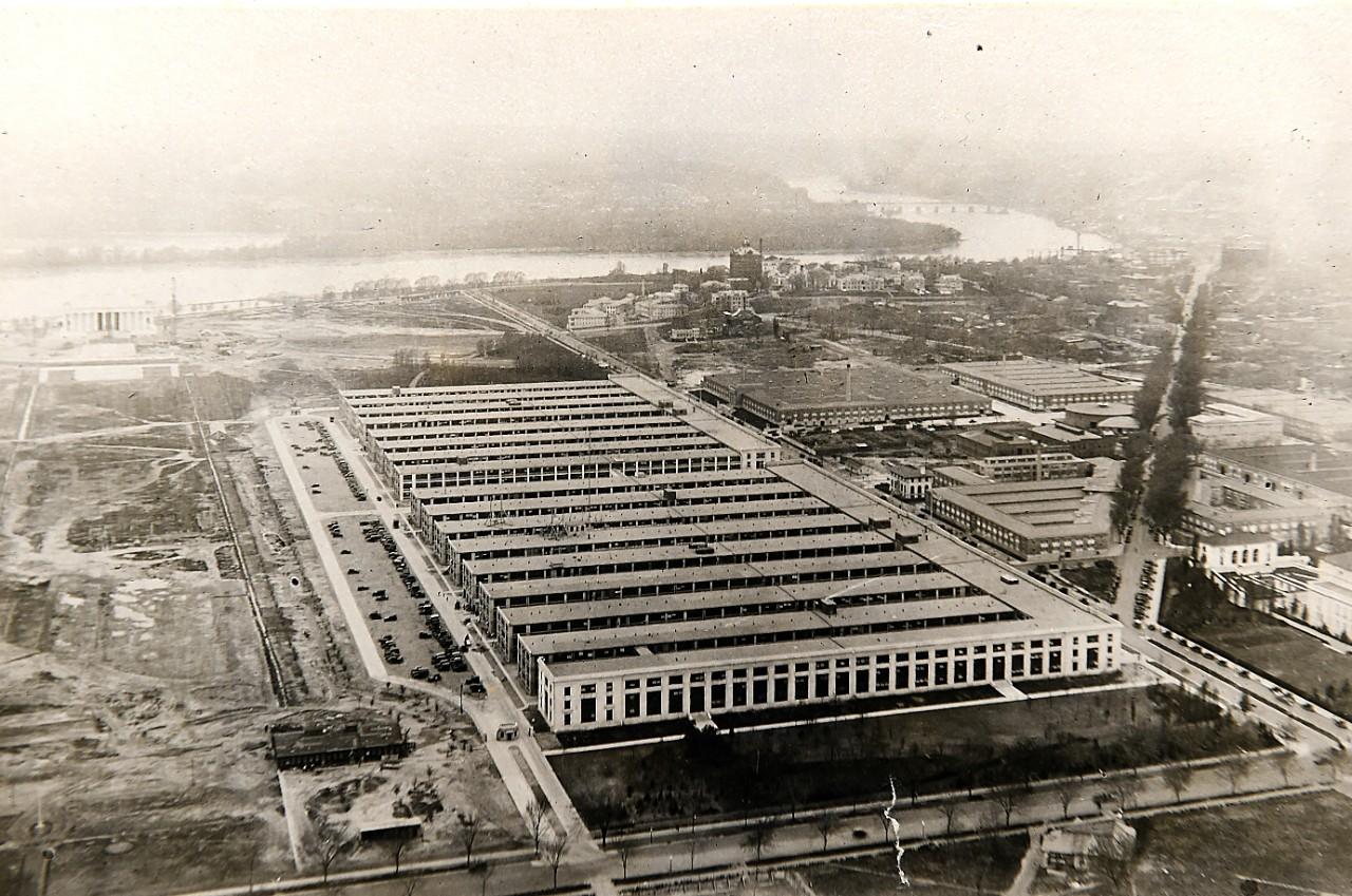
Throughout the twentieth century, dozens of buildings—meant to be temporary in design—sat on what are now open spaces on the National Mall such as Constitution Gardens and the JFK Hockey Fields. Of course, the idea that numerous buildings should occupy these spaces was not new; during the Civil War, the Union Army built a stockade with hospitals and training grounds across the Mall.¹ Another notable example was in the 1902 McMillan plan which had called for numerous grand buildings to line a new Centennial Avenue along the Mall.² However, what set the twentieth century temporary buildings (known as 'Tempos') apart was that most of these were occupied for decades and remained key fixtures of the National Mall's landscape until very recently. While there were dozens of Tempos on the Mall during the twentieth century, two examples stood out as the most long-lasting structures of their kind: these were the Main Navy Building and the Munitions Building.
Figure 1. Naval History and Heritage Command, NH 2502 "Main Navy" and "Munitions" Buildings, n.d. [likely 1918], www.history.navy.mil/our-collections/photography/places/washington-dc/main-navy---munitions-buildings/nh-2502--main-navy--and--munitions--buildings.html.
When Washington became the nation's capital and the seat of the federal government in 1800, the Departments of State, War, and Navy took up residence in various temporary or undersized facilities across the city. Originally, the State and Navy Departments occupied rowhouses in the "Six Buildings" rowhouses on the 2100 block of Pennsylvania Avenue, about five blocks west of the White House; the War Department occupied a house opposite the "Six Buildings".³ Following this, all three departments moved into a new public building southwest of the White House, across from the Treasury Department on the east side of the executive mansion; in 1819, following damage to federal buildings during the War of 1812, the State and War Departments moved into two new buildings to the northeast and northwest of the White House, respectively.⁴
Figure 2. Horse drawn streetcar 3 in front of War Department Building, [approx. 1870], David Sterman Photograph Collection, The People’s Archive, District of Columbia Public Library, Washington, DC. digdc.dclibrary.org/do/85f1822b-9273-4604-9754-e28d7419d817.
Following this, the first executive building in this lineage housing the Departments of State, War, and Navy that remains to this day was built beginning in 1870; the aptly named State, War, and Navy (SWAN) Building is perhaps the most well-known example of French Second Empire-style architecture in the nation's capital.⁵ Today, it is known as the Eisenhower Executive Office Building, sitting to the west of the White House between Pennsylvania and New York Avenues on 17th Street NW, perhaps best seen from bird’s eye view as in figure 3.
Figure 3. [Bird’s eye view of National Mall, showing the extent of Tempo buildings constructed on the Mall], photograph, 1942, Aerial Photography of Washington, D.C. & Vicinity Files, RG328 'Records of the National Capital Planning Commission', National Archives and Records Administration, College Park, MD. catalog.archives.gov/id/235195087. SWAN Building is shown just above the White House in the right-hand side of the photograph.
By 1918, the Navy Department vacated the SWAN building, having outgrown the space; in the decades prior, the State Department had lost forty percent of its original space in the SWAN building to the Navy. The last Secretary of the Navy to occupy an office in the SWAN building was Josephus Daniels in 1921, though Secretaries of the Army continued to work there until Harry Woodring in 1940.⁶ Future President Franklin Delano Roosevelt, at that time serving as Assistant Secretary of the Navy, had initially advocated for more space than had been available at the SWAN building to President Woodrow Wilson in the fall of 1917—the peak of American involvement in the First World War. Originally, he asked to build it on the Ellipse; President Wilson thought that the then-planned to be wooden building would be too unsightly, to which Roosevelt pivoted to the Potomac Park/National Mall location.⁷
Figure 4. US Public Buildings Commission, Mall and Vicinity, Washington, 1927, Washingtoniana Map Collection, The People’s Archive, District of Columbia Public Library, Washington, DC. digdc.dclibrary.org/do/c9c5fa9f-facc-478e-97b0-3f89dce09be8.
The two most prominent ‘tempo’ buildings were the Main Navy Building and the Munitions Building. The buildings—each four stories tall and built out of steel and concrete—were constructed very quickly, in under six months’ time.⁸ In fact, the buildings sat partially on the area which used to be the Tiber Creek, Ripp’s Island, and eventually the canal lock between the Chesapeake and Ohio Canal and Washington City Canal which the Lockkeeper’s House was built to oversee; given that the construction area was filled-in land, piling was needed to reach solid ground for the building foundation below what used to be the riverbed.⁹ Initially, the Munitions Building (the western of the two buildings and the further of the two in figure 1) had eight wings, while the Main Navy Building was built with nine.¹⁰ However, with the increased space needs brought on by the Second World War, the Main Navy Building had been further expanded to add another floor and wing.
Figure 5. John Ferrell, Construction of temporary war emergency buildings on the Mall, near 16th and 17th Streets, N.W. Piles of lumber near the Washington Monument, photograph, March 1942, Farm Security Administration—Office of War Information Photograph Collection, Prints and Photographs Division, Library of Congress, Washington, DC, www.loc.gov/pictures/item/2017764229.
By the end of WWII, the Department of the Navy alone held office spaces in more than twenty-five buildings in the Washington area.¹¹ As for the Army, the War Department was housed in more than seventeen buildings across the city; however, unlike the Navy Department, the War Department had already outgrown spaces built for it during the interwar years and thus the Munitions Building was one of many office buildings they occupied prior to the construction of the Pentagon.¹² Additionally, the area south of the Main Navy and Munitions Building was initially used as a five-hundred vehicle capacity surface parking lot (as visible in figure 1), connected to B Street (now Constitution Avenue) by an alley between the two buildings and a one-hundred-foot-long covered walkway above.¹³ By WWII, even this parking lot had been replaced by Tempos, namely Tempos ‘N’ and ‘W’. Throughout the war, a third of the National Capital Parks’ facilities including the National Mall and Potomac Parks were used to house the military; the military infrastructure on the Mall was developed to such a large extent that even elevated pedestrian bridges were constructed across the Reflecting Pool to join the Tempos.¹⁴ By the end of the war, more than two dozen Tempos dotted the National Mall, with additional Tempos having been built elsewhere in DC, Maryland, and Virginia.
Figure 6. Marjory Collins, Lincoln Memorial lagoon, showing corridors between temporary war buildings, government workers eating lunch on the grass, and small boys swimming, photograph, July 1942, Farm Security Administration—Office of War Information Photograph Collection, Prints and Photographs Division, Library of Congress, Washington, DC, www.loc.gov/pictures/item/2017825884.
Throughout their tenure in the Main Navy Building, the US Navy and Marine Corps housed various different offices and units in the building. Some notable examples include their military photography units, the Office of Naval Intelligence, and the Office of Naval Records and Library.¹⁵ By 1943, the War Department had vacated the Munitions Building upon completion of their spaces at the Pentagon; on the other hand, much of the Navy’s high command remained in the Main Navy building for the entirety of WWII, and only begrudgingly did they completely move to the Pentagon towards the end of the decade.¹⁶
Figure 7. Public buildings in the metropolitan area of Washington, D.C., December 30, 1946, map, Washington, D.C., Library of Congress, Geography and Map Division, www.loc.gov/resource/g3851f.ct004565.
By the 1960s, most of the Tempos on the Mall had been dismantled and demolished. In 1964, demolition work on Tempos ‘I’, ‘J’, ‘K’, ‘L’, ‘3’, ‘4’ and ‘5’—the Tempos on the south side of the Reflecting Pool and the west side of the Washington Monument grounds—were underway. Additionally, contracts were being handed out for the demolition of Tempos in West Potomac Park.¹⁷ Tempo ‘4’, by then having become the headquarters for the Civil Aeronautics Administration (now the FAA), was the first to go; the 767-by-224 foot building was demolished in January, finally unobstructing the view between the Lincoln Memorial and the Washington Monument along 17th Street NW that persists today.¹⁸ President Richard Nixon—himself having been assigned an office in the Main Navy building during his time with the Navy’s Bureau of Aeronautics during WWII—ordered the Main Navy and Munitions Buildings to be demolished in December 9th, 1969.¹⁹ By mid-1970, demolition of the largest Tempos was underway, and spectators even took home pieces of the Main Navy and Munitions Buildings as souvenirs; their demolition, along with that of Tempo ‘E’, was intended to make way for the creation of parkland and reintroduce green space to the Mall that had been absent for much of the interwar period.²⁰ With the American Bicentennial approaching in 1976, construction on Constitution Gardens would begin on the area that had been home to Tempo ‘N’, Tempo ‘W’, and the Main Navy and Munitions Buildings by late-July of 1974, marking the end of the ‘temporary’ structures on the Mall which survived for over half a century.²¹
The National Capital Parks and the Main Navy Building
Figure 8. National Capital Parks office in the Navy Building, February 4, 1937, Box 13, Folder 4, National Park Service, National Capital Region Photograph Collection, The People’s Archive, District of Columbia Public Library, Washington, DC. digdc.dclibrary.org/do/cbe0e989-5c13-45f6-8f1a-22bcdc7bbf14.
Contrary to what the name ‘Main Navy Building’ would indicate, the building’s tenants were not always military offices. In fact, the National Capital Parks unit’s (precursor to the National Park Service’s National Mall and Memorial Parks unit) offices also occupied the building. National Capital Parks Superintendent C. Marshall Finnan’s office, for example, was Room 1052 in the Main Navy Building.²² As seen in figure 7, these office spaces would too eventually be outgrown by their tenants by the mid-twentieth century.
The Last Tempo
Figure 9. National Park Service, Liberty Loan Building, 2017, www.nps.gov/articles/temporary-war-department-buildings.htm.
The last remaining ‘tempo’ was vacated in 2025; this was the Liberty Loan Building, whose final tenant was the U.S. Department of the Treasury’s Bureau of the Fiscal Service. Built as a 'tempo’ in 1919 to house the Liberty Loans bond program during World War I on the southeastern shore of the Tidal Basin, it was originally designed to house 1,200 federal employees. The building, sitting at the southwest corner of the 14th Street SW–D Street SW intersection, can be seen in figures 4 and 6 just south of the Bureau of Engraving and Printing. Though the General Services Administration has announced its plans to dispose of the property from its roster of federal buildings, you can still see the last standing ‘tempo’ while walking around the Mall today!²³